


Monday & Tuesday 08/09 December 2014
New Meaning to Cold Greenhouse
Monday was coldish with sunny spells and Tuesday was cloudy and dull with the wind picking up to gale force into Tuesday evening and the early hours of Wednesday morning. Nothing unusual for December.
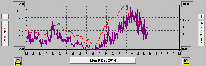
Temperature and Wind Speeds from Monday 08 to Wednesday 10 December 2014
We’ve had a couple of days now where the day’s high temperature has occurred during the night. On Tuesday the highest temperature of 11.9°C occurred at 21:20 before falling back quite rapidly to just above 4°C in the early hours of Wednesday morning.
I always assume it will be warmer in the greenhouse than outside although in spells of prolonged cold weather without any sunshine the temperatures inside and out become more or less equal. Very unusually with the outdoor temperature rising quickly and only for a short time in the hours of darkness the greenhouse highest temperature has been lower than the outside temperature. Inside the greenhouse reached only 8.5°C by 21:20 compared to 11.9°C outside before falling away as the outdoor temperature fell sharply.
At least the plants inside the greenhouse avoided the wind and showers.

Wednesday 10 December 2014
Weather Bombed?
The overnight gales relented by daybreak and throughout the day on Wednesday we had a few spells of wintry sunshine mixed in with some very heavy blustery showers.
I’d not heard of the term “weather bomb” but it seemed to cause a bit of a stir in the newspapers and TV that a weather bomb was approaching the UK. Apparently the term is used to describe a weather phenomenon when the barometric pressure falls by 24mb in less than 24 hours.
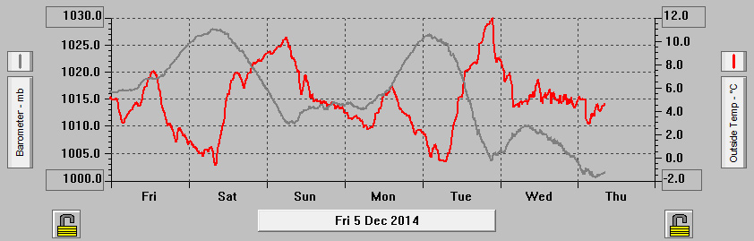
Barometric pressure and Temperature from Friday 05 to Thursday 11 December 2014
Our Ossett weather bomb happened on Tuesday as the barometric pressure fell from a high of 1027.0mb at 01:50 to 1003.8mb at 21:05. Hence the question mark in the title as we managed a fall of 23.2mb not quite managing the 24 required for an official weather bomb.
Thursday 11 December 2014
Lucky Break
Thursday was cold and showery with some sunny intervals. Over the last few days we’ve had lots of heavy showers and these are starting to add up to a considerable amount of rainfall.
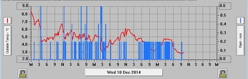
Those showers over the last few days have added up to 25.0mm of rainfall bringing the monthly total up to 36.4mm.
In the lead up to Christmas there are steam hauled charter trains visiting some of the Christmas Markets. Last week they were heading to Lincoln and this week they’re heading for York. We made the short trip out to the East Coast Main Line to photograph The York Yuletide Express from Norwich.
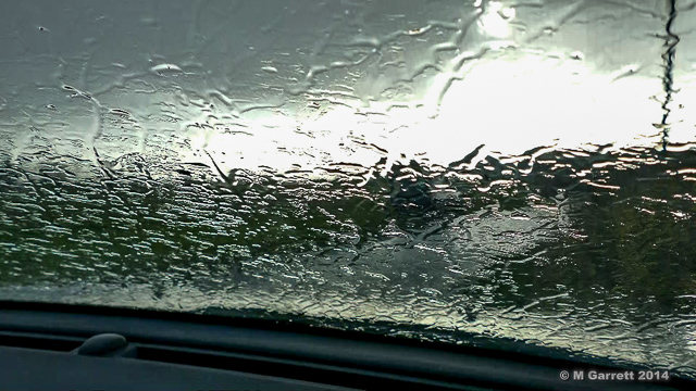
We arrived with a bit of time to spare but the weather wasn’t looking too promising as the rain poured down. I wasn’t planning on getting out of the car in the middle of a downpour on a freezing cold day.
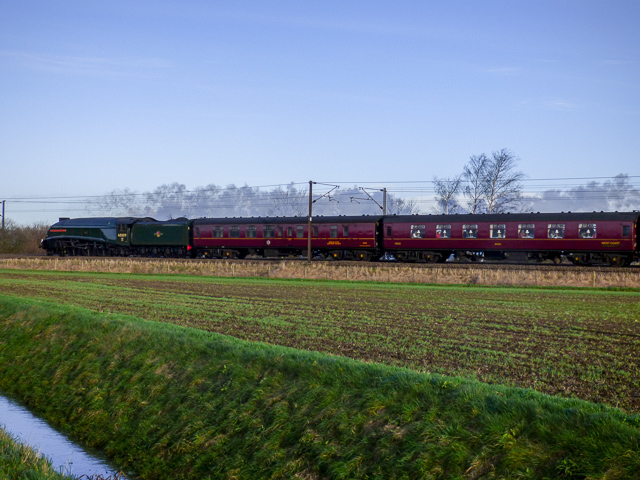
As showers do it passed by with the help of a strong wind and blue sky appeared in time for the arrival of the Yuletide Express. Rather lucky really.
Temperature and Rainfall Records from Wednesday 10-12 December 2014
Friday & Saturday 12/13 December 2014
Coldest Day Since March 2014
Friday and Saturday have been a cold couple of days. Both days had some good sunny spells but only enough to lift the temperature fractionally above 5°C.
Overnight Friday into Saturday the temperature dropped to -1.4°C our coldest night, or should I say early morning because that low temperature was recorded at 08:40, since 24 March 2014 when the temperature fell to -2.4°C.
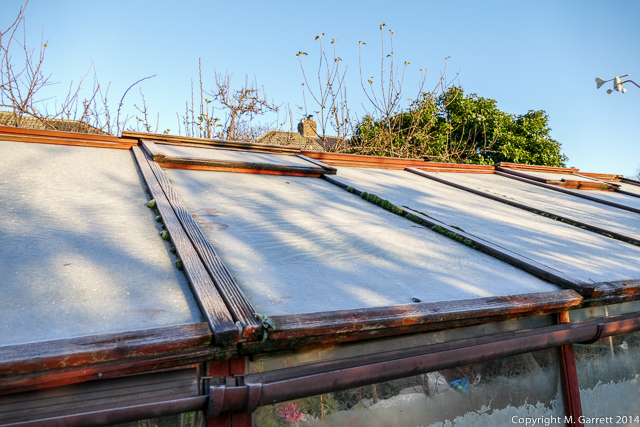
I do hope our plants are surviving in the cold greenhouse. When I took this picture the temperature in the greenhouse was down to -1.3°C very little different to that outside. Perhaps that covering of fleece will make all the difference.