Friday, 23 February 2018
Midnight Potato Rescue!
With all the weather forecasting attention on next week's anticipated cold spell, Thursday night into Friday morning sort of slipped under the radar. Half listening to the weather forecast on TV late last night I heard then give out a severe overnight frost but no temperatures were mentioned and the forecast was soon discussing how cold it was going to be next week. Out of curiosity I checked the outside temperature on my weather station. I got a bit of a surprise.
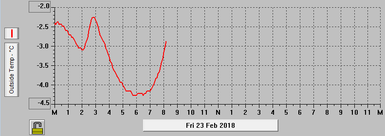
Temperatures Records for 23 February 2018
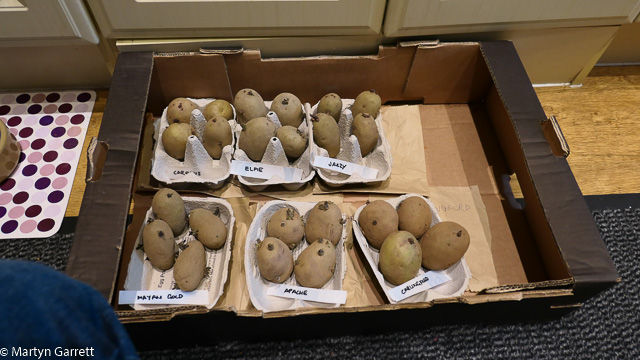
The temperature approaching midnight was already well below freezing. I wondered how low it would fall if it was so cold already and would our seed potatoes survive in the greenhouse. After a quick chat with Sue, we decided it was better to be safe than sorry and nearing midnight I headed up to the greenhouse by torch light to collect our seed potatoes. As a temporary measure they were left on the kitchen floor overnight.
The temperature continued to fall through the night, eventually falling to -4.3°C or 24.3°F. That's our lowest of the year, and for the winter too, beating the previous low of -3.2°C (26.2°F) on 11 December 2017.
The forecast for next week remains cold with severe overnight frost and daytime temperatures struggling to reach 0°C (32°F) so we'll have to put our thinking caps on as to the best place to store our seed potatoes over the next week or so. We need somewhere light and frost free.
Monday, 26 February 2018
Not Much Snow So far This Week
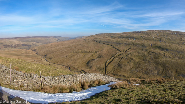
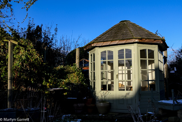
As anyone who has seen the news on UK television recently will be aware of the arrival of the "beast from the east" bringing us some very cold and possibly snowy weather. However, we’ve had two sunny, if cold, days over the weekend. On Saturday we had a visit to the Yorkshire Dales and Cumbria to do some video and photography on the Settle to Carlisle Railway Line.
Our first location was Dent Head Viaduct to catch 60163 Tornado heading north to Carlisle with the North Briton. Unfortunately Tornado had a fault with its TPWS (Train Protection and Warning System). This meant it was necessary for a diesel locomotive to take over the train. The arrival of the train took us by surprise as it silently sped onto the viaduct.
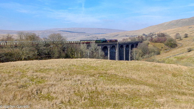
60163 Tornado with The North Briton at Dent Head Viaduct
A bit disappointing but these things happen and we set off to find somewhere for lunch. In the afternoon we had a trip over Buttertubs Pass.
We finished up in Cumbria before we made our way to Ais Gill, the highest point on the Settle to Carlisle railway, to capture our second steam hauled charter train of the day. This time it was 45699 Galatea with the Cumbrian Mountain Express.
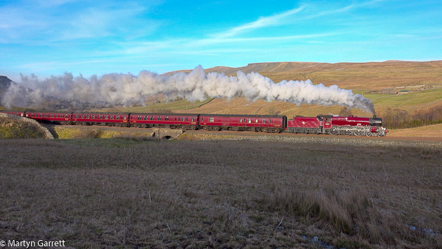
45699 Galatea with The Cumbrian Mountain Express at Ais Gill
Conditions were excellent with lovely clear blue skies. Galatea certainly shattered the peace as it climbed towards the summit of the Settle to Carlisle Railway.
Below are the two videos we made of our visit to the Dales.
60163 Tornado with The North Briton at Dent Head Viaduct
45699 Galatea with The Cumbrian Mountain Express at Ais Gill
Tuesday, 27 February 2018
Forecast Correct - Snow Showers
Monday was declared the coldest day of the year in some places in the UK. I'm not sure it was our coldest day although there are a few different ways of looking at this. The first is simply the lowest temperature we've experienced whilst the second way might be to consider the lowest average daily temperature and thirdly a sort of lowest high if you get my meaning.
Based on the above this winter's coldest days so far are:
- Lowest temperature -4.3°C (24.3°F) on 23 February 2018
- Lowest average daily temperature -0.7°C (30.7°F) on 11 December 2017
- Lowest daily high temperature 1.4°C (34.5°F) on 10 December 2017
In any case it still looks as though Wednesday or Thursday this week will be the coldest day of winter if the forecast is correct.
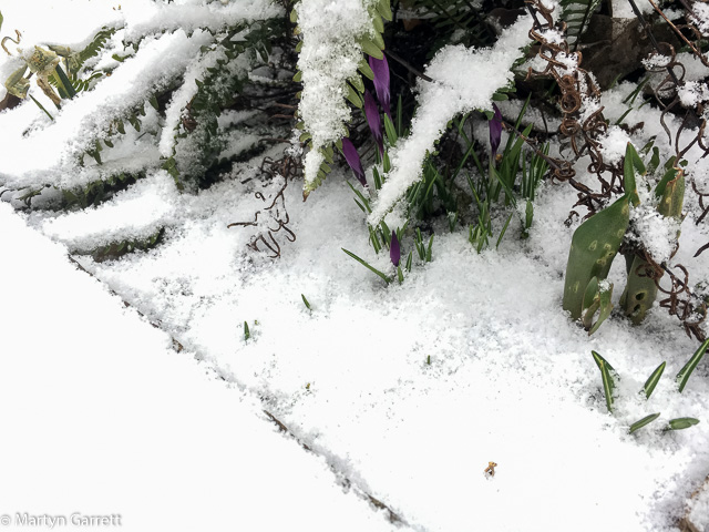
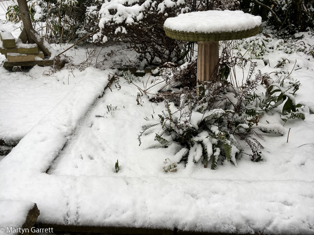
The forecast for this week has been about right. It's cold and we're getting some snow showers. On Monday morning we'd had the lightest covering of snow.
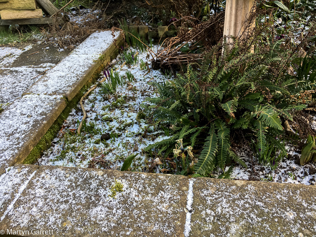
Snowfall - Monday morning 26 February 2018
Despite the cold temperatures and a few snow flurries throughout the day on Monday the little bit of snow that had fallen melted away. Tuesday morning's covering was a little more but nothing very noteworthy.
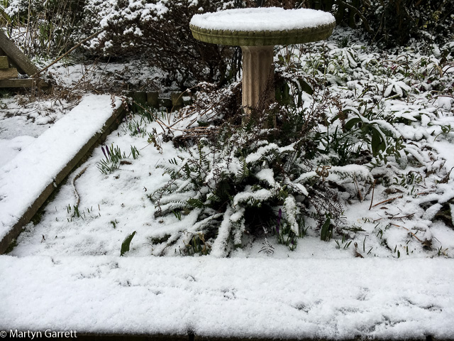
Snowfall - Tuesday morning 27 February 2018
The forecast for the next few days is for the snow showers to continue and for the coldest of the weather to have passed by the end of the weekend. Gardening may resume in a week or so.
It May Be Some Time Before We Go Positive Again
So far Tuesday as been a day of snow showers as forecast. Between the showers we've had some sunny periods, enough to melt some of the snow that's fallen.
Outside it feels bitterly cold even in the sunshine. One of the points the forecasters have been emphasising is the wind chill factor associated with the easterly breeze.
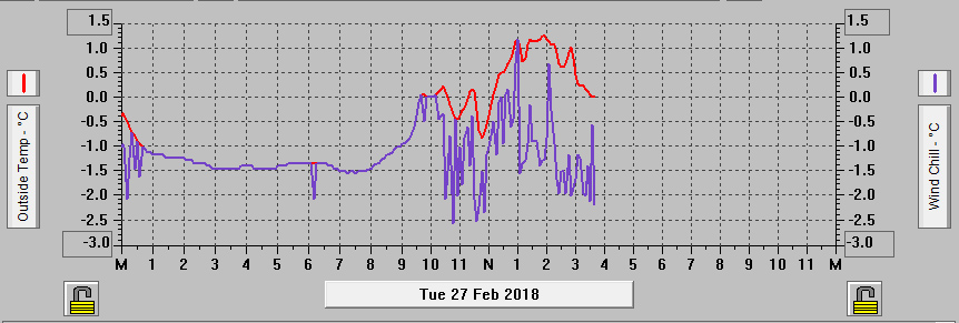
Temperature & Wind Chill Records 27 February 2018
At 16:00 on Tuesday the temperature has just dipped down to freezing point and, looking at the weather model forecasts for the next few days, it will be awhile before the temperature gets back into positive territory.
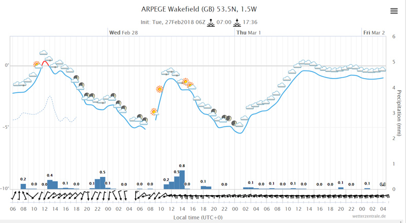
Image from web site http://www.wetterzentrale.de
As you can see from the above chart which runs to early Friday morning we're forecast to be below zero at least until then. Looking at models which extend the forecasting period then it looks like we might have to wait until Saturday morning before we manage to get above freezing point again.
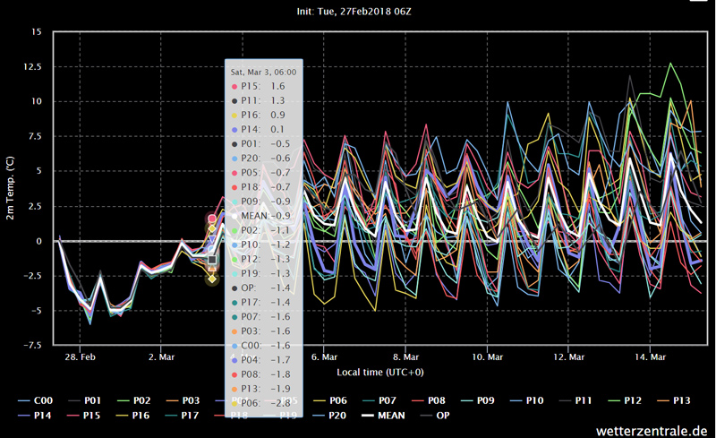
Image from web site http://www.wetterzentrale.de
This would be an unusual and very cold spell of weather for us. It looks so nice outside through the window.
Wednesday, 28 February 2018
Coldest This Winter
It was well forecast that this week was going to be the coldest few days of winter and it's certainly turned out to be the case.
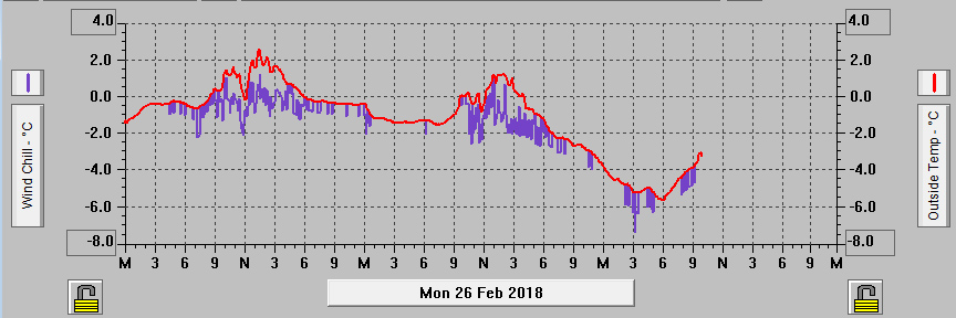
Temperature & Wind Chill Records 26-28 February 2018
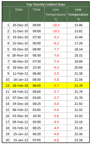
Early on Wednesday morning the temperature fell to -5.7°C (21.7°F) giving us our lowest temperature of the winter. It's our coldest February day since 08 February 2012 when the temperature fell to -5.9°C (21.4°F) and it's our lowest temperature since 16 January 2013 when it fell to -5.8°C or 21.6°F. It's made it into my list of top 20 coldest days.
Yesterday's list of this year's coldest winter temperatures now reads as follows:
- Lowest temperature -5.7°C (21.7°F) on 28 February 2018
- Lowest average daily temperature -1.1°C (30.0°F) on 27 February 2018
- Lowest daily high temperature 1.3°C (34.3°F) on 27 February 2018
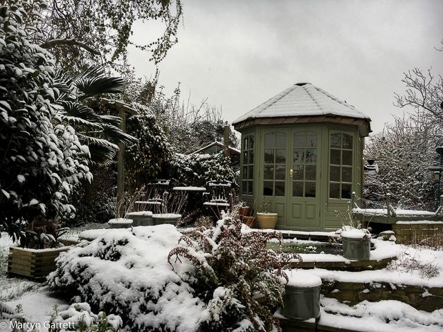
Meanwhile the snow showers continue to fall. They have been more frequent and heavier so far through Wednesday morning.
Snowfall - Wednesday morning 28 February 2018
The forecast suggests tonight might be even colder.